Not even one full week after heavy rain drenched Union County, another round of severe weather is headed toward the region.
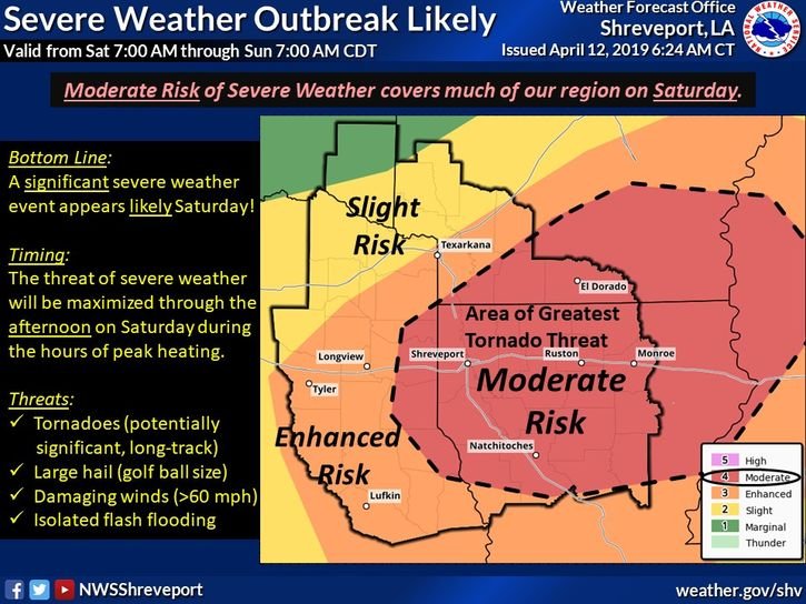
According to the National Weather Service, Union County is at a moderate risk for severe weather on Saturday, which could include large hail, damaging winds and strong tornadoes, along with isolated flooding. Aaron Stevens, a meteorologist with the National Weather Service office in Shreveport, Louisiana, said much of southwestern Arkansas is at risk, along with northern Louisiana.
Stevens said a strong cold front is expected to come through the area, and while some storms are possible Friday night, he noted the severe weather would really start Saturday morning and peak in the afternoon. That’s when there will be the highest risk of strong tornadoes and potential flash flooding.
“It’s a very active Saturday,” Stevens said.
Union County may see 2-4 inches of rain Saturday before the storms gradually move out Saturday night, Stevens said. Last weekend, the area saw more than 8 inches of rain, with several roads completely flooded.
Stevens said the storms should be gone by Sunday, which he said is expected to be sunny with temperatures in the 60s. But more thunderstorms are possible late Tuesday through late Thursday, with the weather service saying some could be strong, resulting in heavy rain and a renewed flooding threat.